Log in
All resources
Create a design
178 Free Artworks of Western World
photographs by edmund f. arras
columbus metropolitan library
oil on canvas
1913 in florence
latin-language maps
maps
views from the lion of waterloo
university of washington
imperial war museum first world war artwork
bird
imperial war museum first world war artwork
surrealism
imperial war museum first world war artwork
surrealism
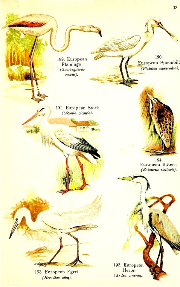
flamingo
bird
survival
fashion
preparatory paintings for statesmen of world war i (james guthrie)
alfred milner, 1st viscount milner
20th-century paintings from denmark
paintings by johannes p. ebbesen
imperial war museum first world war artwork
william roberts
old maps of the county of ravensberg
burg limberg
paintings of birds in sweden
carduelis carduelis in art
bomber
2011
20th-century paintings from denmark
paintings by johannes p. ebbesen
20th-century paintings from denmark
paintings by johannes p. ebbesen
old maps of the western hemisphere
jacob van meurs
maps of budapest by joris hoefnagel
joris hoefnagel
old hemisphere world maps (partner files)
old maps of the western hemisphere
pheasant
bird
jean-fréderic phélypeaux
guillaume dheulland
maps by joachim bormeester
1685 maps
18th-century maps of western europe
1754 maps of europe
pheasant
bird
maps by girolamo ruscelli
maps by girolamo porro
slovak diaspora in the united states
fourth liberty loan
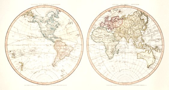
18th-century double hemisphere world maps
1730s maps of the world
victoria of the united kingdom and prince albert
the royal mausoleum, frogmore
graves of monarchs
carlo marochetti
18th-century double hemisphere world maps
1730s maps of the world
paintings of world war i in the canadian war museum
stanley turner
paintings by chen cheng-po
1941 works in taiwan
ridpath's universal history
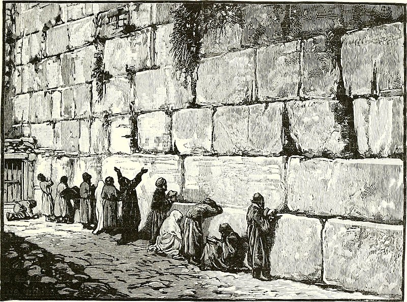
western wall in art
16th-century maps of the persian gulf
maps of the gulf of suez
paintings by filippino lippi in the hermitage
italian renaissance
portraits and tronies by jan lievens
oil on canvas
augustusstraße, dresden
1913 in dresden
paintings in the gemäldegalerie alte meister (dresden)
photographs by edmund f. arras
photographs by edmund f. arras
piazzale michelangelo
photographs by edmund f. arras
dutch baroque architecture
photographs by edmund f. arras
piazzale michelangelo
paintings in the galerie neue meister (dresden)
photographs by edmund f. arras
views from the lion of waterloo
photographs by edmund f. arras
views from the lion of waterloo
photographs by edmund f. arras
views from the lion of waterloo
photographs by edmund f. arras
photographs by edmund f. arras
communs (neues palais)
the expulsion from paradise (albrecht dürer)
german renaissance
david rumsey historical map collection
1794 maps of the holy roman empire
david rumsey historical map collection
1790s maps of the holy roman empire
1913 in berlin
baroque
views from piazzale michelangelo
photographs by edmund f. arras
photographs by edmund f. arras
early renaissance
photographs by edmund f. arras
early renaissance
photographs by edmund f. arras
early renaissance
flemish baroque painting,baroque
photographs by edmund f. arras
maps by peter lesley
maps by james hall
albert theodor gellerstedt
drawings of visby
nationaldenkmal kaiser wilhelm i (berlin)
photographs by edmund f. arras
nationaldenkmal kaiser wilhelm i (berlin)
photographs by edmund f. arras
views from the lion of waterloo
photographs by edmund f. arras
photographs by edmund f. arras
baroque
preparatory paintings for statesmen of world war i (james guthrie)
alfred milner, 1st viscount milner
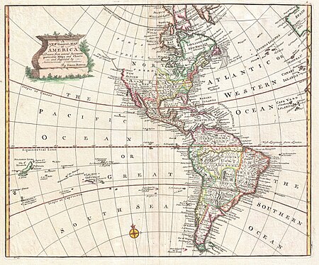
1760s maps of the americas
1764 maps
geocentric model
1730 maps
photographs by edmund f. arras
proto-renaissance,gothic art
photographs by edmund f. arras
proto-renaissance,gothic art
photographs by edmund f. arras
romanticism
the nativity (1958.320) by gerard david
early netherlandish painting
1740s maps of the americas
1747 maps of north america
empress dowager cixi in art
george ernest morrison
1696 maps of the caribbean
1690s maps of mexico
portraits by adolf ulrik wertmüller
neoclassicism
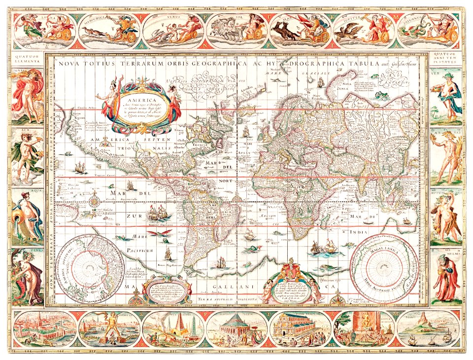
mappe-monde geo-hydrographique (sanson and jaillot, 1674)
cartography of france
18th-century maps of antarctica
1741 maps
carte de barbarie, nigritie, guinée par guillaume delisle (1707)
university of washington
1650s maps of the americas
1658 maps
mappe-monde geo-hydrographique (sanson and jaillot, 1674)
maps of the iberian peninsula by guillaume delisle
1700s maps of the iberian peninsula
carte de moscovie by guillaume de l'isle (1706)
university of washington
carte de l'afrique françoise par guillaume delisle (1726)
philippe buache
australia
maps
western
maps
101 - 178 of 178
/ 2